
Dera Ismail Khan: History, Culture, CPEC and Tourism
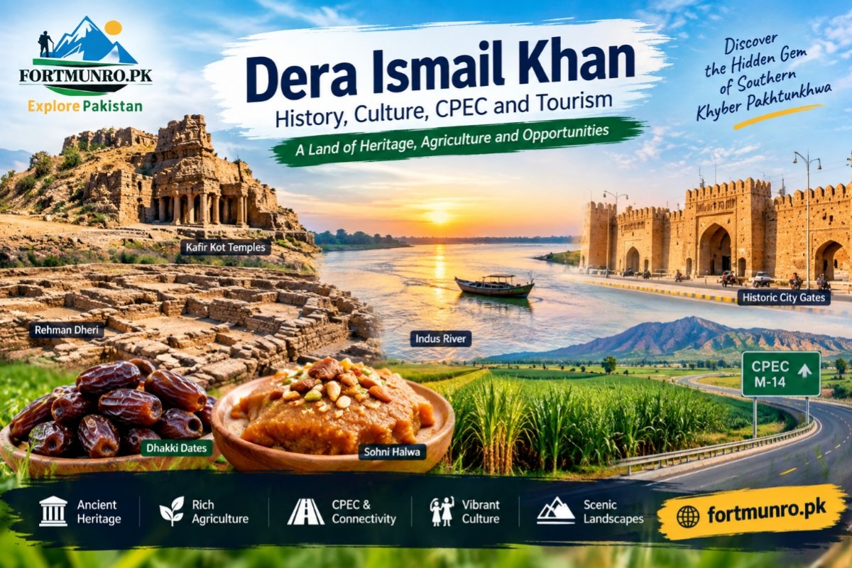
Explore Dera Ismail Khan, a historic KP district known for Rehman Dheri, Kafir Kot, CPEC, agriculture, Seraiki culture, dates and Sohni Halwa.
Introduction
Dera Ismail Khan is one of the most historic and geographically important districts of southern Khyber Pakhtunkhwa, Pakistan. Located along the western bank of the Indus River, Dera Ismail Khan connects the cultural and geographical landscapes of Khyber Pakhtunkhwa, Punjab and Balochistan.
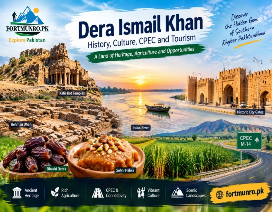
The history of Dera Ismail Khan reaches back thousands of years, with Rehman Dheri representing one of the earliest organized urban settlements of the region. From the ancient Kafir Kot temples to the historic walled city, the area preserves remarkable evidence of different civilizations and historical periods.
Today, Dera Ismail Khan is also an important agricultural, commercial and transportation center. The CPEC western route, Hakla–D.I. Khan Motorway, CRBC irrigation system, famous Dhakki dates and traditional Sohni Halwa have strengthened the district’s economic and cultural identity.
Location and Geographical Importance of Dera Ismail Khan
Dera Ismail Khan is situated in the southern part of Khyber Pakhtunkhwa on the Indus River basin. The district headquarters is Dera Ismail Khan city, while the wider district extends from fertile river plains toward the rugged foothills and semi-arid Daman region.
Its geographical position gives Dera Ismail Khan exceptional strategic importance because the district lies close to the boundaries and routes connecting Khyber Pakhtunkhwa with Punjab and Balochistan.
Borders and Natural Landscape
- North: Tank and Lakki Marwat districts
- East: Bhakkar and Mianwali across the Indus River
- South: Dera Ghazi Khan district of Punjab
- West/Southwest: South Waziristan and routes toward Zhob and Sherani
- East: Fertile Indus River plains
- West: Foothills and rugged terrain associated with the Sulaiman mountain system
The landscape of Dera Ismail Khan therefore combines riverine agriculture, irrigated farmland, sandy Daman areas and mountainous terrain.
Administrative Structure of Dera Ismail Khan
The district has a large geographical area and includes several tehsils that represent its urban, agricultural and western mountainous regions.
Main Tehsils
- Dera Ismail Khan
- Paharpur
- Paroa
- Kulachi
- Daraban
- Paniala
- Darazinda
Darazinda has particular administrative significance because it was formerly part of the tribal administrative system and became part of the regular district structure following the constitutional reforms.
Ancient History and Archaeological Heritage
The historical importance of Dera Ismail Khan is strongly connected with archaeological remains dating back thousands of years. Rehman Dheri and Kafir Kot are among the most important historical attractions associated with the wider district.
Rehman Dheri: An Ancient Urban Settlement
Rehman Dheri is an important archaeological site near Dera Ismail Khan and is generally associated with the pre-Harappan period. Archaeological remains indicate an organized settlement with planned streets, houses, pottery and other material evidence.
The site demonstrates that organized urban life existed in this part of the Indus region before the mature phase of the Harappan civilization. This makes Rehman Dheri an important part of the ancient history of Dera Ismail Khan.
Kafir Kot and Hindu Shahi Temples
Kafir Kot is another remarkable archaeological heritage site associated with the region. The remains of ancient temples and stone structures reflect architectural traditions connected with the Hindu Shahi period.
The ruins around Kafir Kot and Bilot are particularly significant for visitors interested in archaeology, ancient architecture and the cultural history of the Indus frontier.
History of the Modern City
The history of modern Dera Ismail Khan includes repeated interaction with the Indus River, local rulers and later British administration.
The original settlement was traditionally associated with Malik Sohrab Khan Dodai and was named after his son Ismail Khan. A devastating flood and river erosion in the nineteenth century destroyed the older settlement, after which the city was rebuilt farther from the river.
From the 1823 Flood to the Walled City
The major flood of 1823 played an important role in the transformation of the city. By 1825, Nawab Sher Muhammad Khan Sadozai is associated with the rebuilding and planned development of the new city.
The historic city was organized around a grid pattern and enclosed by a defensive wall. Its traditional gates, including Kabul Gate, Topanwala Gate, Multan Gate and Khan Zaman Gate, remain important symbols of the city’s historic character.
CPEC and the Strategic Importance of Dera Ismail Khan
The development of the CPEC western route has increased the strategic importance of Dera Ismail Khan. Its location makes it an important connection between northern Pakistan, southern Khyber Pakhtunkhwa and routes toward Balochistan.
Hakla–D.I. Khan Motorway (M-14)
The Hakla–D.I. Khan Motorway is an important road link associated with the CPEC western route. It has improved road connectivity between Islamabad and Dera Ismail Khan and has strengthened the district’s role as a transportation and commercial gateway.
Dera Ismail Khan also provides important connections toward Zhob, Quetta and other areas of Balochistan, while the Indus River and structures such as the Chashma Barrage and Chashma Bridge contribute to its connectivity with Punjab.
Agriculture, CRBC and Local Economy
Agriculture is one of the major economic foundations of Dera Ismail Khan. The Indus River plains and irrigation infrastructure have helped transform large areas into productive agricultural land.
Chashma Right Bank Canal and Agricultural Development
The Chashma Right Bank Canal, commonly known as CRBC, has played an important role in irrigating agricultural areas of the district. Irrigation has supported the cultivation of crops such as wheat, sugarcane, maize and cotton.
The agricultural economy of Dera Ismail Khan is further supported by orchards and traditional crops, including dates and mangoes.
Famous Agricultural Products
- Dhakki dates from the Paharpur area
- Mangoes from irrigated and Daman areas
- Citrus fruits
- Wheat
- Sugarcane
- Maize
- Cotton
Dhakki dates are particularly famous for their size, softness and sweetness and are an important agricultural identity of the region.
Famous Food: Sohni Halwa of Dera Ismail Khan
Sohni Halwa is one of the most recognizable traditional foods associated with Dera Ismail Khan. Prepared traditionally using ingredients such as desi ghee, milk, samnak and dry fruits, the sweet has become a popular local gift.
For many visitors, taking home traditional Sohni Halwa is part of experiencing the food culture of Dera Ismail Khan.
Culture, Languages and Local Traditions
The culture of Dera Ismail Khan reflects a distinctive combination of Seraiki and Pashtun traditions. Seraiki, particularly the local Dera dialect, is widely associated with the urban and plain areas, while Pashto is prominent in many western and rural communities.
The district’s social culture has developed through the interaction of different tribes and communities over centuries.
Traditional Culture of Dera Ismail Khan
Traditional cultural activities include:
- Dera-style Jhummar
- Traditional wrestling and local akharas
- Horse and spear-related traditional activities
- Hujra and Dera culture
- Local festivals and family gatherings
- Traditional Seraiki and Pashtun hospitality
This cultural diversity gives Dera Ismail Khan a distinctive identity within southern Khyber Pakhtunkhwa.
Tourist and Historical Places in Dera Ismail Khan
Visitors interested in history, nature and local culture can explore several places associated with the district.
| Place | Main Attraction |
|---|---|
| Rehman Dheri | Ancient archaeological settlement |
| Kafir Kot | Hindu Shahi-era archaeological ruins |
| Bilot | Ancient temples and historical remains |
| Indus River | Riverside scenery and recreation |
| Chashma Barrage | Water reservoir and recreational area |
| Historic City Gates | Remains of the old walled city |
Why Visit Dera Ismail Khan?
- Explore ancient archaeological heritage at Rehman Dheri.
- Discover the historic Kafir Kot and Bilot ruins.
- Experience the landscape of the Indus River.
- Taste traditional Sohni Halwa and local foods.
- Explore the region’s Seraiki and Pashtun cultural heritage.
- Learn about the district’s role in the CPEC western route.
Education and Healthcare
Dera Ismail Khan is also an important educational and healthcare center for southern Khyber Pakhtunkhwa. Gomal University, established in 1974, has played a significant role in higher education, particularly in agriculture, pharmacy and scientific fields.
The district also has medical and teaching institutions that provide education and healthcare services to residents of D.I. Khan and surrounding districts.
Quick Answer
What is Dera Ismail Khan famous for?
Dera Ismail Khan is famous for its ancient archaeological heritage, Rehman Dheri, Kafir Kot, Indus River landscape, Dhakki dates, Sohni Halwa, agriculture, Seraiki-Pashtun culture and its strategic importance along the CPEC western route.
Where is Dera Ismail Khan located?
Dera Ismail Khan is located in southern Khyber Pakhtunkhwa on the western side of the Indus River, near the boundaries of Punjab and routes toward Balochistan.
Why is Dera Ismail Khan important?
Its importance comes from its ancient history, agricultural production, geographical location, cultural diversity and growing transportation and trade connections.
Location of Dera Ismail Khan
Dera Ismail Khan is located in southern Khyber Pakhtunkhwa along the Indus River. Its position makes it an important geographical link between Khyber Pakhtunkhwa, Punjab and Balochistan.
The district’s location also places it along important transportation corridors, including the CPEC western route and Hakla–D.I. Khan Motorway.
Conclusion
Dera Ismail Khan is much more than a southern district of Khyber Pakhtunkhwa. Its archaeological heritage, especially Rehman Dheri and Kafir Kot, connects the region with thousands of years of South Asian history. The Indus River and surrounding landscape have also shaped its settlement patterns, agriculture and local economy.
Modern Dera Ismail Khan combines ancient heritage with contemporary development. Irrigation through the CRBC has supported agriculture, while Dhakki dates, mangoes and traditional Sohni Halwa have strengthened the district’s identity. Its Seraiki and Pashtun cultural traditions further add to the diversity of the region.
With improved road connectivity and its position on the CPEC western route, Dera Ismail Khan has growing strategic and economic importance. The combination of history, archaeology, agriculture, culture, food and transportation makes it an important destination and a significant part of Pakistan’s southern Khyber Pakhtunkhwa region.
جی، اس بلاگ کے لیے 10 SEO-friendly FAQs سوالات انگلش میں اور جوابات اردو میں:
FAQs.
Where is Dera Ismail Khan located?
ڈیرہ اسماعیل خان خیبر پختونخوا کے جنوبی حصے میں دریائے سندھ کے مغربی کنارے پر واقع ہے۔ اس کی جغرافیائی حیثیت اسے پنجاب اور بلوچستان سے ملانے والے اہم خطے میں شامل کرتی ہے۔
What is Dera Ismail Khan famous for?
ڈیرہ اسماعیل خان رحمان ڈھیری، کافر کوٹ، دریائے سندھ، ڈھکی کی کھجوروں، سوہن حلوے، زراعت اور اپنی سرائیکی و پشتون ثقافت کے لیے مشہور ہے۔
Why is Dera Ismail Khan historically important?
ڈیرہ اسماعیل خان کی تاریخی اہمیت ہزاروں سال پرانی ہے۔ رحمان ڈھیری قدیم شہری تہذیب کی اہم مثال ہے، جبکہ کافر کوٹ کے آثار ہندو شاہی دور کی تاریخی وراثت کو ظاہر کرتے ہیں۔
What is Rehman Dheri in Dera Ismail Khan?
رحمان ڈھیری ڈیرہ اسماعیل خان کے علاقے میں واقع ایک اہم قدیم آثارِ قدیمہ کا مقام ہے، جہاں منظم شہری آبادی، مکانات، گلیوں اور قدیم برتنوں کے شواہد ملے ہیں۔
What is Kafir Kot famous for?
کافر کوٹ قدیم پتھریلے مندروں اور تاریخی کھنڈرات کے لیے مشہور ہے۔ یہاں موجود آثار قدیمہ کے شائقین کو خطے کے قدیم مذہبی اور تعمیراتی ورثے سے روشناس کراتے ہیں۔
Why is Dera Ismail Khan important for CPEC?
ڈیرہ اسماعیل خان سی پیک کے مغربی روٹ پر ایک اہم جغرافیائی مقام رکھتا ہے۔ ہکلہ–ڈی آئی خان موٹروے نے اسے اسلام آباد اور ملک کے دیگر حصوں سے بہتر سڑک رابطے فراہم کیے ہیں۔
What crops are grown in Dera Ismail Khan?
ڈیرہ اسماعیل خان میں گندم، گنا، مکئی اور کپاس سمیت مختلف فصلیں کاشت کی جاتی ہیں۔ نہری آبپاشی اور دریائے سندھ کے قریب زرخیز زمین نے علاقے کی زرعی پیداوار میں اہم کردار ادا کیا ہے۔
What are Dhakki dates famous for?
ڈھکی کی کھجوریں اپنے بڑے سائز، نرم گودے اور منفرد مٹھاس کے لیے مشہور ہیں۔ یہ ڈیرہ اسماعیل خان کی اہم زرعی پیداوار اور مقامی شناخت کا حصہ ہیں۔
What is Dera Ismail Khan Sohni Halwa?
ڈیرہ اسماعیل خان کا سوہن حلوہ ایک معروف روایتی سوغات ہے جو دیسی گھی، دودھ، سمنک اور خشک میوہ جات جیسے اجزا سے تیار کیا جاتا ہے۔ اسے مقامی اور بیرونِ ملک بطور تحفہ بھی پسند کیا جاتا ہے۔
What are the best historical and tourist places in Dera Ismail Khan?
ڈیرہ اسماعیل خان میں رحمان ڈھیری، کافر کوٹ، بلوٹ کے تاریخی آثار، دریائے سندھ کا کنارہ، چشمہ بیراج اور تاریخی شہر کے قدیم دروازے قابلِ ذکر مقامات ہیں۔